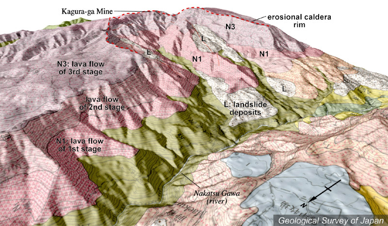
| 地質陰影図(北西→南東、15゜)。苗場火山山頂の北側にある大規模な崩壊地形(侵食カルデラ)。手前は秋山郷のある中津川。カルデラ縁上の右のピークが苗場山山頂、その左が神楽ヶ峰。 | |
|
|
| 地質図:島津光夫・立石雅昭(1993)苗場山地域の地質。地域地質研究報告(5万分の1地質図幅)、地質調査所、90p。 | |||
| Topographic relief combined with geological map of Naeba Volcano (tilted by 15°from the NW to the SE). Nakatsugawa River is located in the foreground. The summit of Naeba Volcano is located on the caldera rim, and Kaguragamine on the left side of the summit. An erosion caldera on the northern side of the summit. | Map
courtesy of K. Nakajima |
||