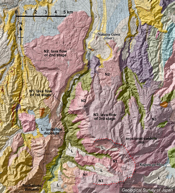
| 地質陰影図。苗場火山の山頂は図の下端の中央右寄り。その上(北側)には大規模な崩壊地形(侵食カルデラ)が西北西に開いて広がる。南北に流れる中津川の左岸、図の上左(北西)に広がる起伏のある緩斜面(桃色)は、苗場火山の溶岩流とされる。図下端の左端は鳥甲火山の山頂部。 | |
|
|
| 地質図:島津光夫・立石雅昭(1993)苗場山地域の地質。地域地質研究報告(5万分の1地質図幅)、地質調査所、90p。 | |||
Topographic relief combined with geological map around Naeba Volcano。The summit of the volcano in the bottom. An erosion caldera near the summit is open to the west. The undulated slopes on the upper left (indicated by pink) are composed of lava flows erupted from Naeba Volcano. |
K. Nakajima |