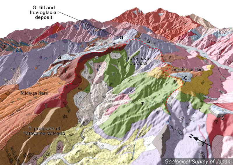
| 地質陰影図(南西→北東、30゜)。立山カルデラの左に弥陀ヶ原、右に五色ヶ原。カルデラ内にも分布する約20万年前の古期火山岩類(黄緑色)の一部は、もともとの凹地に堆積したと考えられている。 | |
|
|
| 地質図:原山 智・高橋 浩・中野 俊・苅谷愛彦・駒澤正夫(2000)立山地域の地質。地域地質研究報告(5万分の1地質図幅)、地質調査所、218p。 | |||
| Topographic relief around Tateyama Volcano combined with geological map (tilted by 30°from the SW to the NE). Midagahara Plateau on the left side of the caldera, and Gosikigahara Plateau on the right side of the caldera. Older volcanic rocks (indicated by light green, about 200 thousand years old) are presumed to deposit in the depression. | Map
courtesy of K. Nakajima |
||