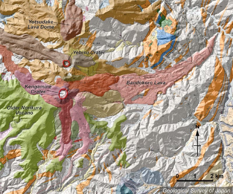
| 地質陰影図。北から四ッ岳溶岩ドーム(茶色)、恵比須溶岩丘、剣ヶ峰火口を持つ剣ヶ峰溶岩丘が連なる。東西斜面に新期の溶岩流が流れている。東に谷を埋めて流れたのが番所溶岩。南西の千町尾根(黄緑色)は古期乗鞍火山。 | |
|
|
| 地質図:中野 俊ほか(1995)乗鞍岳地域の地質。地域地質研究報告(5万分の1地質図幅)、地質調査所、139p。 | |||
| Topographic relief around Norikura Volcano combined with geological map. Yotsudake Lava Dome in the N, Yebisu Crater and Kengamine Lava Cone in the center. The valley in the E was filled with Bandokoro Lava. Older Norikura Volcano (green-colored) is located on the lower left. | K. Nakajima |