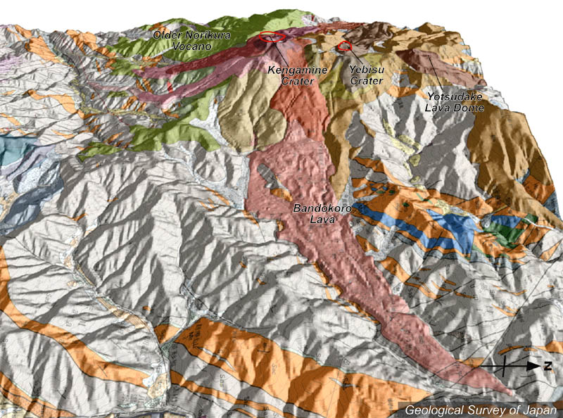
| 地質陰影図(東→西、35°)。手前に大規模な谷埋めの溶岩流(桃色、番所溶岩)が広がる。左が古期乗鞍火山(黄緑色)。 | |
|
|
| 地質図:中野 俊ほか(1995)乗鞍岳地域の地質。地域地質研究報告(5万分の1地質図幅)、地質調査所、139p。 | |||
| Topographic relief of Norikura Volcano combined with geological map (tilted by 35 degree from the E to the W). The valley on this side was filled with thick Bandokoro Lava. Older Norikura Volcano (green-colored) is located on the left. | Map
courtesy of K. Nakajima |
||