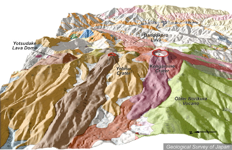
| 地質陰影図(西→東、15°)。中央の恵比須岳や右の剣ヶ峰火口から手前に最新期の溶岩流が流れている(暗茶色、紫色)。右の尾根(黄緑色)は古期乗鞍火山。 | |
|
|
| 地質図:中野 俊ほか(1995)乗鞍岳地域の地質。地域地質研究報告(5万分の1地質図幅)、地質調査所、139p。 | |||
| Topographic relief of Norikura Volcano combined with geological map (tilted by 15 degrees from the W to the E). Lava flows by the latest eruption from Ebisu Crater (center) and Kengamine craters (right) are indicated by dark brown, and purple. Older Norikura Volcano (green-colored) is located on the right. | K. Nakajima |