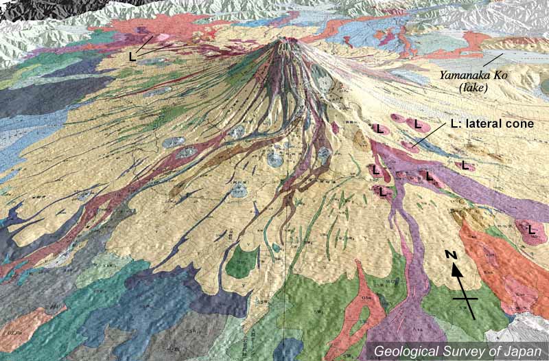
| 地質陰影図(南→北、30°)。山頂の右下(南東)に宝永火口がある。山頂近くから多数の溶岩流が流下している。南東側山腹(右下)だけでなく、南麓から南西麓にかけても側火山が分布する。 | |
|
|
| 地質調査総合センター編(2002)富士火山地質図(1:50,000)CD-ROM版、数値地質図G-9、地質調査総合センター。 | |||
| Topographic relief of Fuji Volcano combined with geological map (tilted by 30 degrees from the S to the N), showing a large amount of lavas flowed from near the summit. Lateral cones not only on the southeastern slope (on the lower right), but on the southern to southwestern slope. | K. Nakajima |