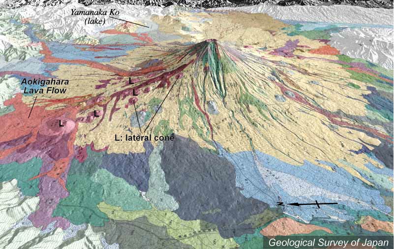
| 地質陰影図(西→東、30°)。山頂部から大沢くずれの谷が発達する。北西方向(左手前)山腹に側火山が集中している。左端の最大のスコリア丘が大室山。その少し山頂側の長尾山付近などから青木ヶ原溶岩流が流出した。 | |
|
|
| 地質調査総合センター編(2002)富士火山地質図(1:50,000)CD-ROM版、数値地質図G-9、地質調査総合センター。 | |||
| Topographic relief of Fuji Volcano combined with geological map (tilted by 30 degrees from the W to the E), showing concentration of lateral cones on the northwestern slope (on the left). The largest scoria cone (Omuroyama) is located on the left end. | Map
courtesy of K. Nakajima |
||