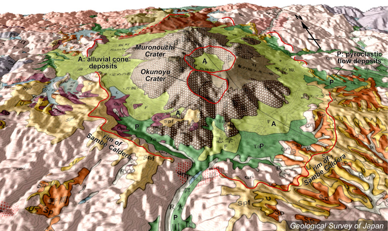
| 地質陰影図(南→北、30゜)。直径4*6kmの三瓶カルデラ内に三瓶溶岩ドームがあり、その中心には室ノ内火口。その手前に奥の湯火口。カルデラ床の大部分は崖錐(黄緑色)などに覆われる。 | |
|
|
| 地質図:服部 仁・鹿野和彦・鈴木隆介・横山勝三・松浦浩久・佐藤博之(1983)三瓶山地域の地質。地域地質研究報告(5万分の1図幅)、地質調査所、168p。 | |||
| Topographic relief of Sambesan area combined with geological map (tilted by 30° from the S to the N). Sambe lava domes located in the Sambe Caldera (4 x 6 km in diameter). Muronouchi Crater in the center and Okunoyu Crater in front. Most of the caldera floor was covered by talus deposits (greenish yellow). | Map courtesy of
K. Nakajima |
||