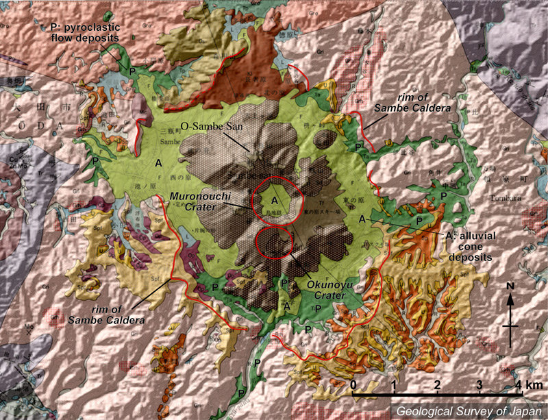
| 地質陰影図。直径4*6kmの三瓶カルデラ内に、男三瓶山を中心にした三瓶溶岩ドームがある。中央に室ノ内火口、その南に奥の湯火口。カルデラ床の大部分は崖錐(黄緑色)などに覆われるが、その下位の火砕流(緑色)が谷沿いにカルデラ外まであふれ出ている。 | |
|
|
| 地質図:服部 仁・鹿野和彦・鈴木隆介・横山勝三・松浦浩久・佐藤博之(1983)三瓶山地域の地質。地域地質研究報告(5万分の1図幅)、地質調査所、168p。 | |||
| Topographic relief of Sambesan area combined with geological map. Sambe lava domes comprise the Sambe Caldera (4 x 6 km) including Osambesan Lava Dome. Muronouchi Crater in the center and Okunoyu Crater in the south. Most of the caldera floor was covered by talus deposits (greenish yellow) that are underlain by ignimbrite (green) along the valley outside the caldera. | Map
courtesy of |
||