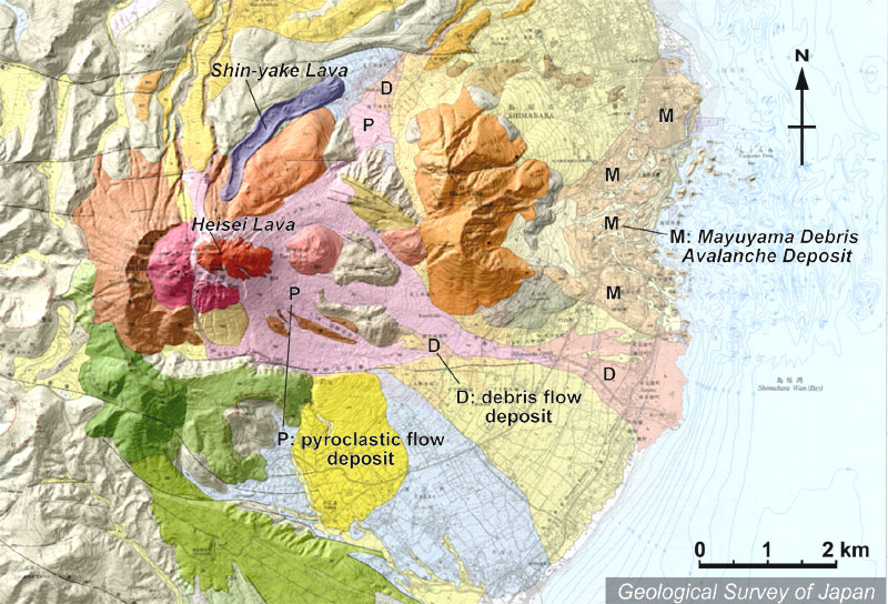
地質陰影図。1991-95年に活動した山頂部の溶岩ドーム(平成新山、赤茶色)から東山麓に火砕流(淡桃色)と土石流(淡肌色)の堆積物が広がる。平成新山の北には1792年の新焼溶岩(紫色)。東の眉山は1792年に大崩壊をおこしており、海中まで流れ山が広がる。 |
|
|
|
| 地質図:渡辺一徳・星住英夫(1995)雲仙火山地質図。火山地質図8、地質調査所。 | |||
Topographic relief of Unzen Volcano combined with geological map. Heisei Shinzan Lava Dome (reddish brown), formed during the 1991-95 eruption, generated pyroclastic flows (P) and debris flows (D) towards the E. Shin'yake lava flow (purple) from the 1792 eruption on the northern flank. Mayuyama (on the eastern flank) collapsed in 1792 and generated huge debris avalanche deposits with hummocky hills extending into the sea. |