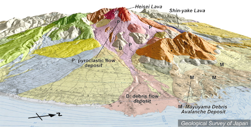
地質陰影図(東南東→西北西、10°)。1991-95年に活動した山頂部の溶岩ドーム(平成新山、赤茶色)から手前山麓に火砕流(淡桃色)と土石流(淡肌色)の堆積物が広がる。右は眉山で、1792年に山体崩壊をおこした。 |
|
|
|
| 地質図:渡辺一徳・星住英夫(1995)雲仙火山地質図。火山地質図8、地質調査所。 | |||
Topographic relief of Unzen Volcano combined with geological map (tilted by 10° from the ESE to the WNW). Heisei Shinzan Lava Dome (reddish brown), formed during the 1991-95 eruption, generated pyroclastic flows (P in the foreground) and debris flows (D in the foreground) towards the E. Mayuyama (right) collapsed in 1792. |