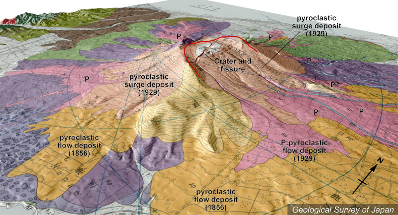
| 地質陰影図(南東→北西、20°)。東に開いた馬蹄形火口内には、北北西-南南東方向に伸張した割れ目火口列がある。山体の表面は1929年の火砕流(ピンク色)や火砕サージ(肌色)の堆積物が広がっている。 |
|
|
|
| 地質図:勝井義雄ほか(1989)北海道駒ヶ岳火山地質図。火山地質図5、地質調査所。 | |||
| Topographic relief of Komaga-take Volcano combined with geological map (tilted by 20° from the SE to the NW). Eruptive fissure in the horseshoe-shaped collapsed scar open towards the east. Slopes of the volcano are mostly covered by pyroclastic flow (pink) and pyroclastic surge deposits (light orange). | K. Nakajima |