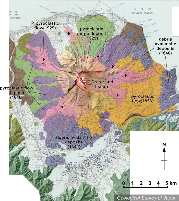
| 地質陰影図。南や東の山麓には流れ山を持つ1640年の岩屑なだれ堆積物(紫)が分布する。それを覆って何枚もの火砕流が広がる。西麓にも古い岩屑なだれ堆積物が広がっている。 |
|
|
|
| 地質図:勝井義雄ほか(1989)北海道駒ヶ岳火山地質図。火山地質図5、地質調査所。 | |||
| Topographic relief of Komaga-take Volcano combined with geological map. Debris avalanche deposits of 1640 spread on the southern and eastern slope (purple) overlain by several pyroclastic flows; older debris avalanche deposits on the western slope. | K. Nakajima |