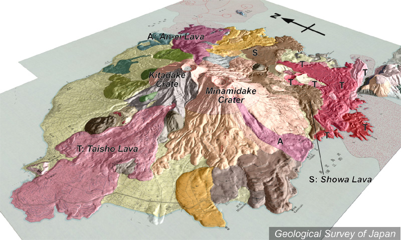
地質陰影図(南西→北東、35°)。山頂に右が南岳、左が北岳。手前山腹から大正溶岩が流出。左上から左手前には扇状地堆積物(淡黄色)が広がる。 |
|
|
|
| 地質図:福山博之・小野晃司(1981)桜島火山地質図。火山地質図1、地質調査所。 | |||
Topographic relief of Sakurajima combined with geological map (tilted by 35° from the SW to the NE). Minamidake on the right and Kitadake on the left. Taisho Lava erupted from the western flank. Volcanic apron extends from the northern to the southwestern flank. |
|
| Geological Map: Fukuyama and Ono (1981) Geological map of Sakurajima Volcano. Geological map of volcanoes, no.1, Geological Survey of Japan. | |