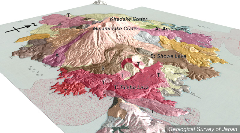
地質陰影図(南東→北西、20°)。山頂部は北岳(右上)と南岳(左下)。現在活動中なのは南岳。手前に1914-15年の大正溶岩(T)が広がり、大隅半島と陸続きになっている。その上を1946年の昭和溶岩が覆う。山頂の右下や左下から流下している溶岩(A)は1779年の安永溶岩。大正溶岩と安永溶岩は海中に流入している。 |
|
|
|
| 地質図:福山博之・小野晃司(1981)桜島火山地質図。火山地質図1、地質調査所。 | |||
Topographic relief of Sakurajima combined with geological map (tilted by 20° from the SE to the NW). Summit craters comprise northern Kita-dake and active southern Minami-dake. Lava flows of 1914-915 (Taisho Lava Flow; T) that covered the W and the SE flank and bridge the island and the mainland, were covered by the 1946 lava flow (Showa Lava Flow). The 1779 lava flows (An-ei Lava Flow; A) erupted from lateral craters located northeast and south of the summit. An-ei and Taisho lavas both flowed into the sea. |
|
| Geological Map: Fukuyama and Ono (1981) Geological map of Sakurajima Volcano. Geological map of volcanoes, no.1, Geological Survey of Japan. | |