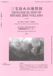
Miyakejima Volcano
1: Introduction / 2: Topography of Miyakejima Volcano
3: History of eruptions of Miyakejima Volcano
4: Eruption of 2000 and collapse of the summit
5: Rocks of the Miyakejima Volcano
6: Possible future activities and hazard prediction / 7: Observation and monitoring
References
![]() PREV
PREV ![]() NEXT
NEXT
1: Introduction / 2: Topography of Miyakejima volcano
1: Introduction
Miyakejima Volcano is situated 200 km to the south of Tokyo and one of the most active volcanoes in Japan with many recorded eruptions since 1085. The latest eruption started on June 26th 2000 for the first time for 17 years with a large magma intrusion followed by ash fall and low temperature pyroclastic flow, formation of collapse caldera, and a release of copious sulfur dioxide gas. This type of eruption has no precedent in the historical record. As the concentration of sulfur dioxide gas exceeded environmental standard, all the residents of the island, about 3,800, were forced to evacuate the island from September of the same year. After four and half years' wait the evacuees were allowed to return to the island from February 2005.
This volcanic geologic map is a compilation of the results of eruptive history, and geologic and lithological studies hitherto available. It is hoped this is utilized for disaster mitigation, reconstruction planning, and prediction of eruption.
2: Topography of Miyakejima volcano
Miyakejima Volcano has an elongated shape in NS direction with about 25km NS by 15 km EW including submarine parts ( depth of the sea about 400 m ). The island has circular outline with a diameter of about 8 km above the sea. The highest point reaches 783 m a.s.l. In the west to north flanks of the volcano at about 350 m a.s.l., a collapse caldera named Kuwanokitaira exists. Outside slopes of the caldera are deeply incised where oldest part of the volcano is exposed. Inside of the Kuwanokitaira caldera is post-caldera volcano, and at about 700 m a.s.l. of it is a collapsed Hatchodaira caldera with the size of 1.8 km NS by 1.6 km EW. Thus it was a double caldera volcano. Later, within the Hatchodaira caldera is a post-caldera volcano, Oyama, which again collapsed near the summit to form a new caldera in the summer of 2000.
In Miyakejima Volcano, eruptions from fissures radiating from the summit have occurred often besides those from the summit. There are many aligned scoria cones and maars ( explosion craters ), among which the latter were originated from phreatomagmatic explosions where the fissures met the sea. Examples of maars include Furumio where Tairoike is located and Shin-Mioike ( now just a trace ) created during 1763 eruption. Fluid lava flowed down along valleys formed lava fan on the foot areas and at the coast. Where the new lavas do not exist as in western and northern coast, continuous sea cliffs over 50 m high are developed.
![]() PREV
PREV ![]() NEXT
NEXT
