
“Urban Geological Map” is developed by 3D modeling of geological strata in urban areas, based on borehole logs and other geological and geomorphological data. The web-based application outputs 2D and 3D geological maps, cross-sections along the arbitrary lines, and borehole data used for 3D geomodeling. This new style of geological map is under development in the Tokyo metropolitan area.
View Urban Geological Map
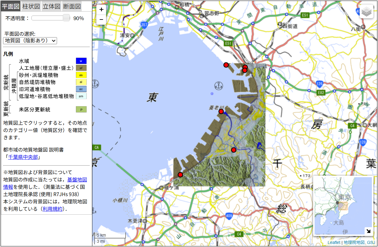
The Urban Geological Map of the Central Area of Chiba Prefecture is a cooperative work with the Chiba Prefectural Environmental Research Center (CERC).
[Explanatory text]
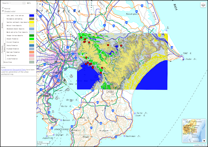
The Urban Geological Map of the Northern Extension Area of Chiba Prefecture is a cooperative work with the Chiba Prefectural Environmental Research Center (CERC).
[Explanatory text]
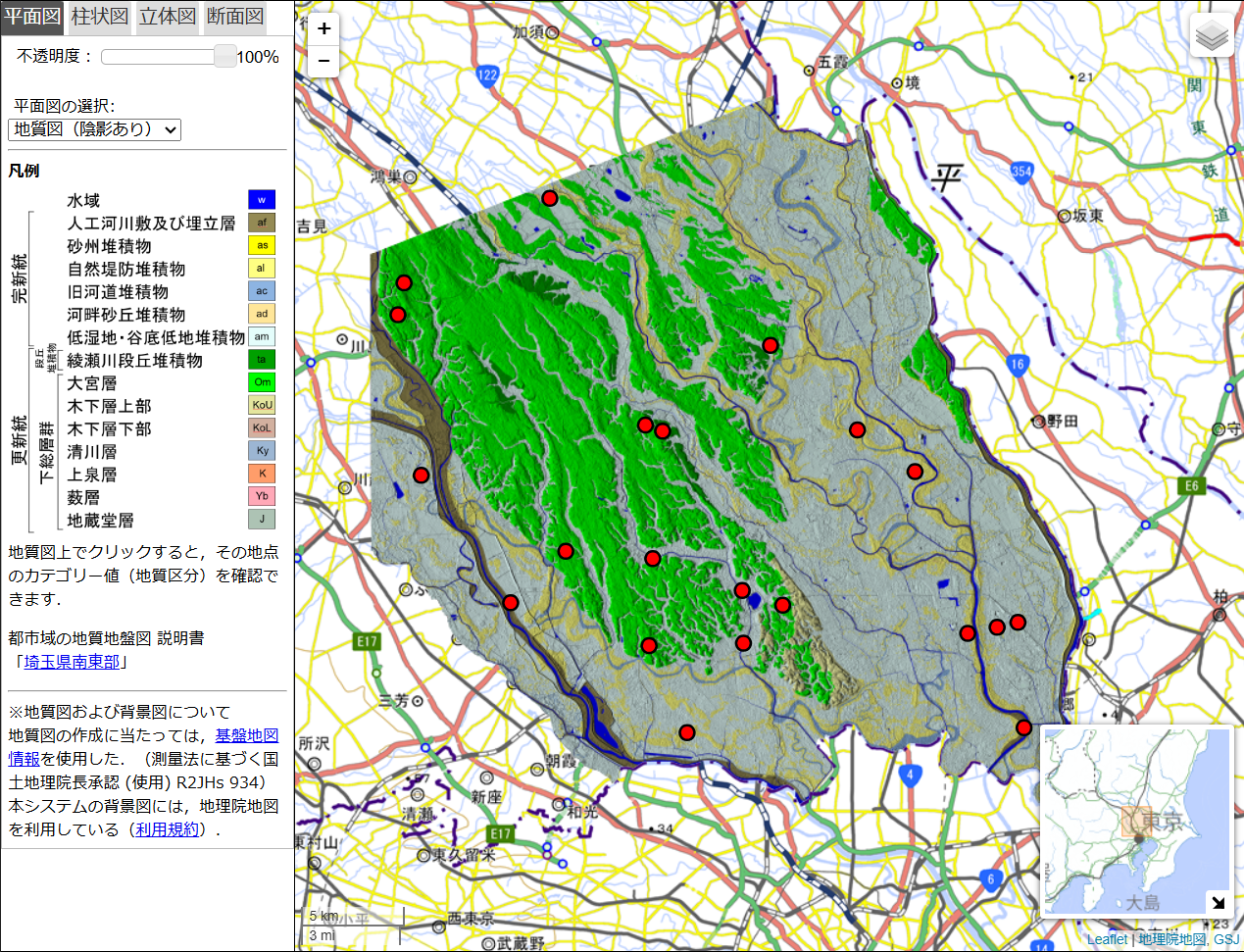
The Urban Geological Map of the Southeastern Area of Saitama Prefecture: Additional Contents is a cooperative work with the National Research Institute for Earth Science and Disaster Resilience (NIED).
[Explanatory text]
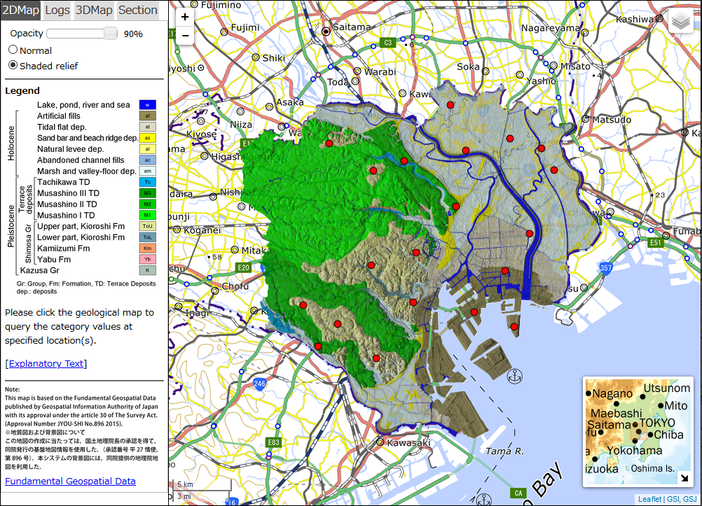
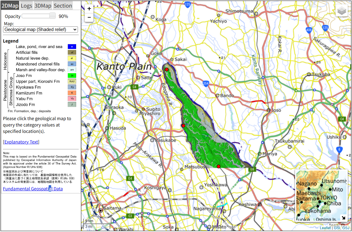
The Urban Geological Map of the Southeastern Area of Saitama Prefecture is a cooperative work with the Center for Environmental Science in Saitama (CESS).
[Explanatory text]
The Urban Geological Map of Central Tokyo is a cooperative work with the Civil Engineering Support and Training Center, Construction Beaurou, Tokyo Metropolitan Government.
[Explanatory text]
The Urban Geological Map of the Northern Area of Chiba Prefecture is a cooperative work with the Chiba Prefectural Environmental Research Center (CERC).
[Explanatory text]
[Explanatory text]
The Urban Geological Map of the Northern Extension Area of Chiba Prefecture is a cooperative work with the Chiba Prefectural Environmental Research Center (CERC).
[Explanatory text]
The Urban Geological Map of the Southeastern Area of Saitama Prefecture: Additional Contents is a cooperative work with the National Research Institute for Earth Science and Disaster Resilience (NIED).
[Explanatory text]
The Urban Geological Map of the Southeastern Area of Saitama Prefecture is a cooperative work with the Center for Environmental Science in Saitama (CESS).
[Explanatory text]
The Urban Geological Map of Central Tokyo is a cooperative work with the Civil Engineering Support and Training Center, Construction Beaurou, Tokyo Metropolitan Government.
[Explanatory text]
The Urban Geological Map of the Northern Area of Chiba Prefecture is a cooperative work with the Chiba Prefectural Environmental Research Center (CERC).
[Explanatory text]
News
| Mar. 31st, 2026 | Release | 3D geological map of central Chiba area and northern Chiba extention area released. |
|---|---|---|
| Mar. 31st, 2026 | Release | Contour maps of geological boundaries in central Chiba area and northern Chiba extention area released. |
| Mar. 31st, 2026 | Release | 2D geological map of central Chiba area and northern Chiba extention area released. |
| Mar. 31st, 2026 | Release | Standard borehole data of central Chiba area and northern Chiba extention area released. |
| Mar. 31st, 2026 | Release | Additional contents (H/V peak frequency map) of southeastern Saitama area released. |
Contact
"Urban Geological Map Project"
Research Institute of Geology and Geoinformation, Geological Survey of Japan (GSJ)
National Institute of Advanced Industrial Science and Technology (AIST)
Address: AIST Central 7, 1-1-1 Higashi, Tsukuba, Ibaraki, 3058567 JAPAN
E-mail: urbangeol-ml(a)aist.go.jp (Please replace (a) with @ )
Contact to GSJ click here.