

| Opacity |
 Please click the diplayed geological map or contour map to query the category values at specified location(s).
Fundamental Geospatial Data
Instruction
Please click a rectangular area to visualize/download 3D model.
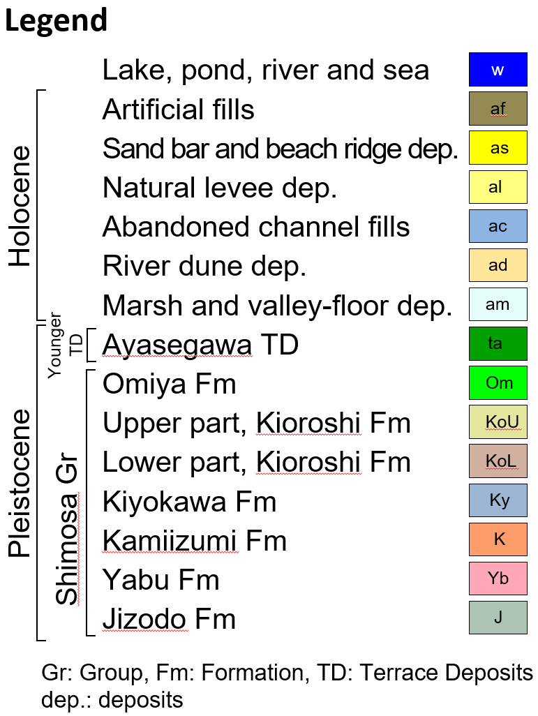
Note: Legend of borehole logs in 3D model is here.
Fundamental Geospatial Data
Please click a rectangular area to visualize/download 3D model.
Note: Legend of borehole logs in 3D model is here.
Fundamental Geospatial Data
Instruction
Step1: Set from/to points by moving the box marks on map window.
Step2: Choose the top/bottom level and vertical exaggeration from the pull-down menu.
Step3: Click “Go” button bellow.
Note: This work takes about one minute. If you get a timeout error, shorten the red line.
Note: Geology in sea area is not drawn in cross-section image.
Fundamental Geospatial Data