Urban Geological Map Project
1.Background

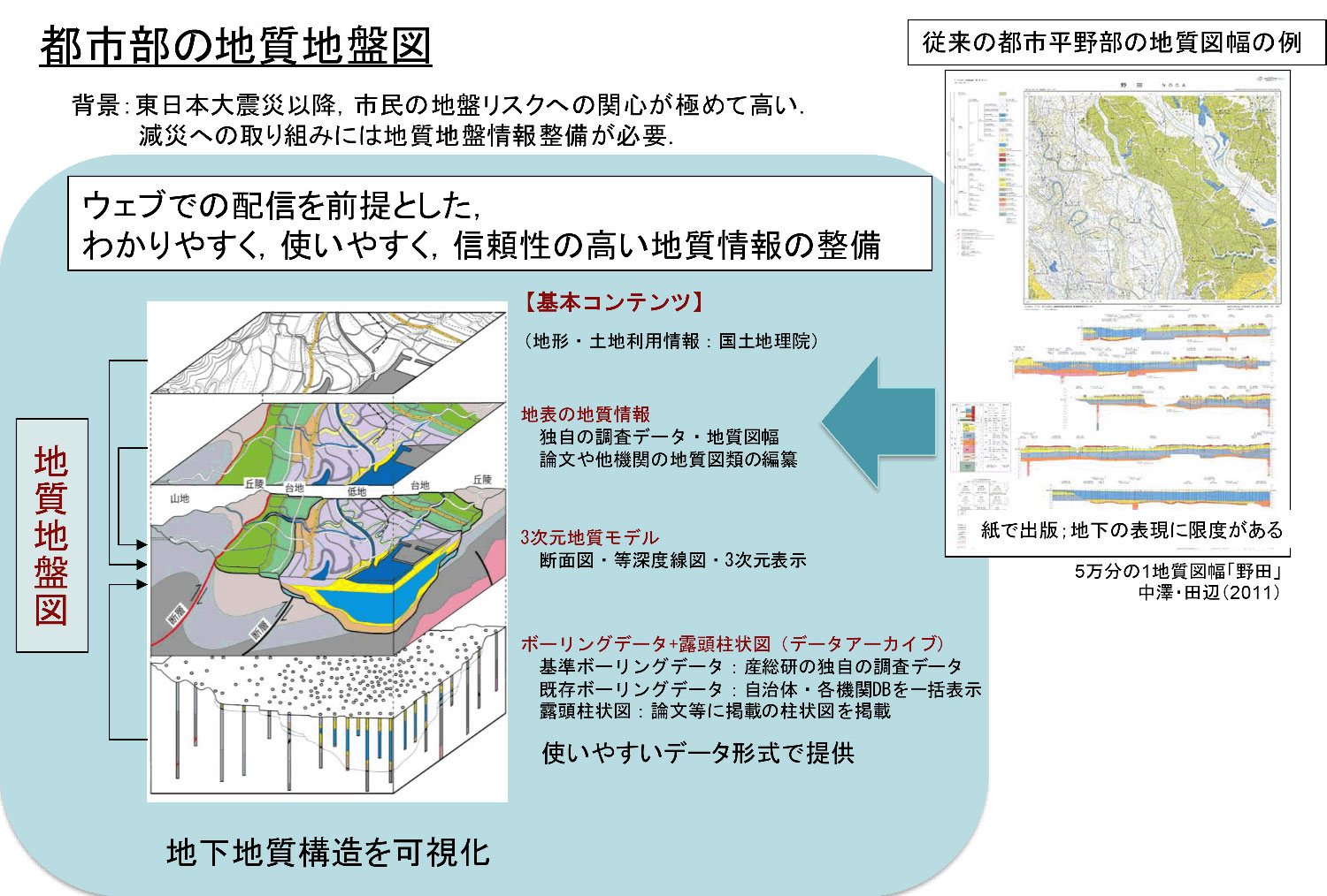
In recent years, the general public has expressed growing concern over geological conditions in urban areas, especially as related to possible occurrences of large earthquakes. To improve the public’s understanding of geological conditions in urban areas, AIST is in the process of developing 3D geological maps that clearly display the distribution of geological strata, based on borehole logs and other geological and geomorphological data.
2. Method

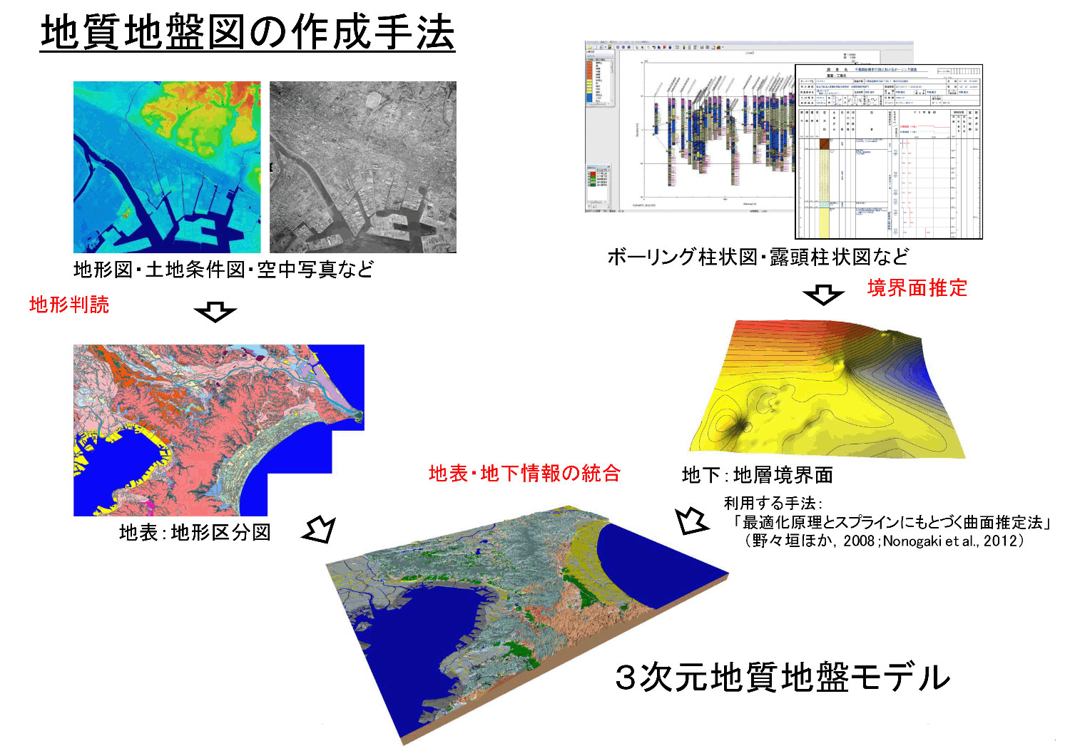
Data on surficial geomorphology and subsurface geological structures are necessary to accurately display geological information in three dimensions. The ground surface data are derived from geomorphological classifications based on topographic maps and aerial photographs. The subsurface structures are estimated by a 3D model that is constructed on the basis of borehole datasets including information on unit boundaries. The 3D geological map is then developed by integrating the geomorphological and geological data.
3. Web-baesd application

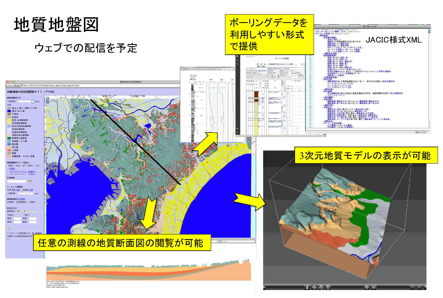
We are currently developing a web-based application that outputs the geological data in a form accessible to the public. The application will display geological maps (2D and 3D), geological cross-sections, and subsurface borehole data in an easily utilizable format. The geoinformation will be continuously updated as new data become available.
References
Nakazawa, T., Nonogaki, S. and Miyachi, Y. (2016) Three-dimensional urban geological map —New style of geoinformation in an urban area—. Synthesiology, vol. 9, p. 73–85. (in Japanese with English abstract)
