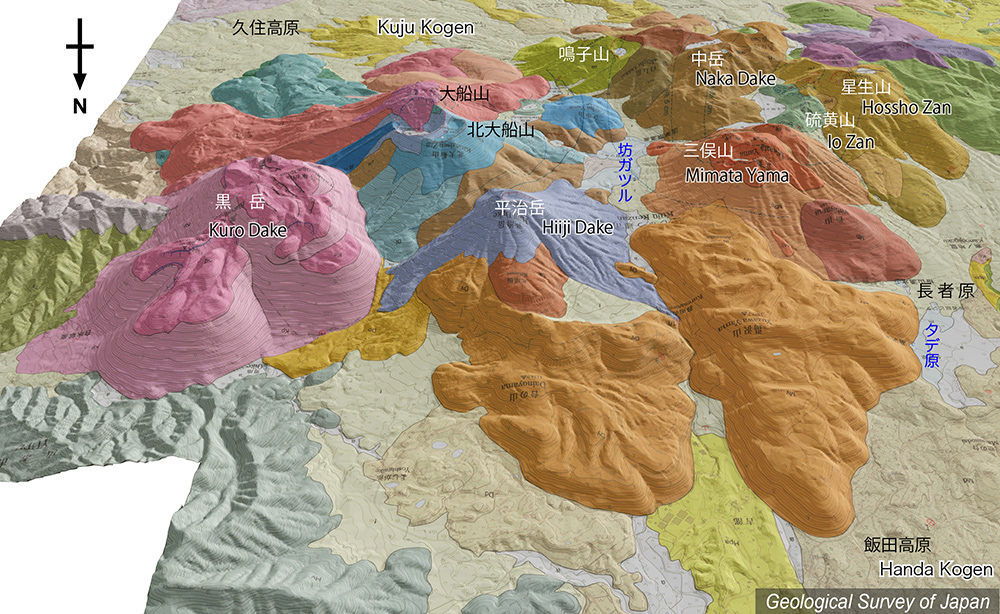
地質陰影図(北→南、35°)。東端の黒岳が最新のマグマ活動により形成された溶岩ドーム群(1,600年前)。西側の火山ほど古い。中岳はくじゅう連山の最高峰となる。硫黄山一帯では噴気活動が活発で、1995年の噴火は星生山との間で発生した。 |
|||
| 地質図:川辺禎久・星住英夫・伊藤順一・山崎誠子(2015)九重火山地質図。火山地質図19、産総研地質調査総合センター。 | |||
| Topographic relief of Kuju Volcano combined with geological map (tilted by 35° from the N to the S). The youngest magma eruption occurred at the eastern end of the volcano group (1,600 years ago). Naka Dake is the highest peak among the volcano group. Vigorous fumarolic activityes accurred around Io Zan. | Map courtesy of K. Nakajima |
||
| Geological Map: Kawanabe et al. (2015) Geological map of Kuju Volcano. Geological map of volcanoes, no.19, Geological Survey of Japan, AIST. | |||