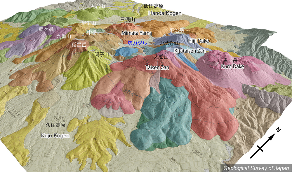
地質陰影図(南東→北西、30°)。1600年前、火山群の東端で最新のマグマ噴火が起こり黒岳(溶岩ドーム群)が形成された。 |
|||
| 地質図:川辺禎久・星住英夫・伊藤順一・山崎誠子(2015)九重火山地質図。火山地質図19、産総研地質調査総合センター。 | |||
| Topographic relief of Kuju Volcano combined with geological map (tilted by 30° from the SE to the NW). Kuju Volcano is a volcano group composed of many small-scale stratovolcanoes, pyroclastic cones and lava domes in a wide area of 13 by 10 kilometers. The youngest magma eruption occurred at the eastern end of the volcano group (1,600 years ago). | Map courtesy of K. Nakajima |
||
| Geological Map: Kawanabe et al. (2015) Geological map of Kuju Volcano. Geological map of volcanoes, no.19, Geological Survey of Japan, AIST. | |||