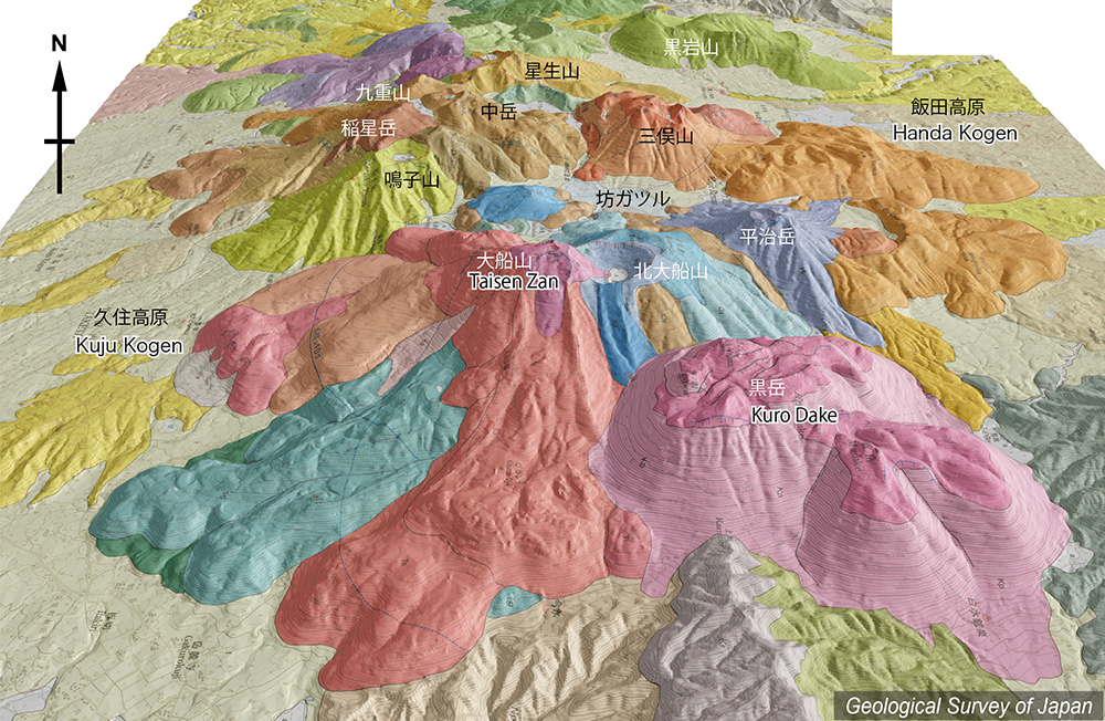
地質陰影図(東→西、35°)。火山体の東側に比較的新しい火山がある。大船山(溶岩ドーム)、北大船山(火砕丘)、最新のマグマ噴火が起こった1600年前に形成された黒岳(溶岩ドーム群)。北大船山には米窪火口と段原火口の二重の火口がある。 |
|||
| 地質図:川辺禎久・星住英夫・伊藤順一・山崎誠子(2015)九重火山地質図。火山地質図19、産総研地質調査総合センター。 | |||
| Topographic relief of Kuju Volcano combined with geological map (tilted by 35° from the E to the W). Relatively younger volcanoes exist at the eastern part of the volcano group. Kurodake Lava domes are the youngest (1,600 years ago), and Taisenzan Lava Domes and Kitataisenzan Pyroclastic Cone with Komekubo and Danbaru Craters. | Map courtesy of K. Nakajima |
||
| Geological Map: Kawanabe et al. (2015) Geological map of Kuju Volcano. Geological map of volcanoes, no.19, Geological Survey of Japan, AIST. | |||