日本の火山 > 第四紀火山 > 個別火山 > 画像集 > 画像
Volcanoes of Japan > Quaternary Volcanoes > Volcano > Photo Gallery > Image
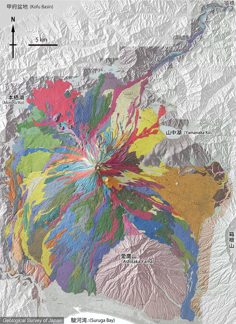
富士山 ______ Fuji San |
富士火山の地質陰影図。津屋(1968)の地質図を36年ぶりに全面改訂。おおむね赤系統が2300年前以降の、青・緑系統はそれ以前の噴出物。黄色系統は土石流・火砕流・扇状地など、茶色は山体崩壊堆積物。 |
|||
| 地質図:高田 亮・山元孝広・石塚吉浩・中野 俊(2016)富士火山地質図 第2版。特殊地質図12、産総研地質調査総合センター。 | |||
| Topographic relief of Fuji Volcano combined with geological map. Reddish colors: products since 2,300 years ago. Bluish and greenish colors: products before 2,300 years ago. Yellowish colors: debris flow, pyroclastic flow, fan deposits and so on. Brownish colors: debris avalanche deposits by sector collapses. | |||
| Takada, A., Yamamoto, T., Ishizuka, Y. and Nakano, S. (2016) Geological map of Fuji Volcano (Second Edition). Miscellaneous Map Series 12, Geological Survey of Japan, AIST. | |||