日本の火山 > 第四紀火山 > 個別火山 > 画像集 > 画像
Volcanoes of Japan > Quaternary Volcanoes > Volcano > Photo Gallery > Image
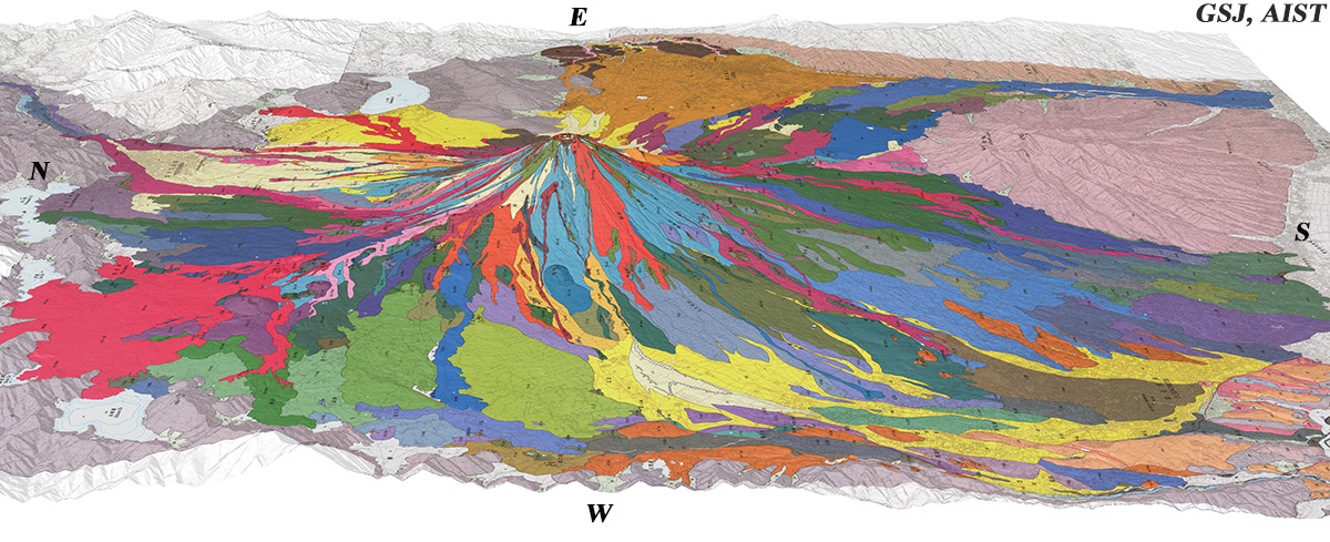
富士山 ______ Fuji San |
富士火山の地質陰影図(西→東、20゚)。赤系統は2300年前以降の溶岩流。左端は9世紀の青木ヶ原丸尾溶岩流。右は愛鷹山。 |
|||
| 地質図:高田 亮・山元孝広・石塚吉浩・中野 俊(2016)富士火山地質図 第2版。特殊地質図12、産総研地質調査総合センター。 | |||
| Topographic reliefs of Fuji Volcano combined with geological map (tilted by 20゚, from the W to the E). A Red- colored area at the left end is Aokigahara-marubi Lava Flows in AD 864-866. | |||
| Takada, A., Yamamoto, T., Ishizuka, Y. and Nakano, S. (2016) Geological map of Fuji Volcano (Second Edition). Miscellaneous Map Series 12, Geological Survey of Japan, AIST. | |||