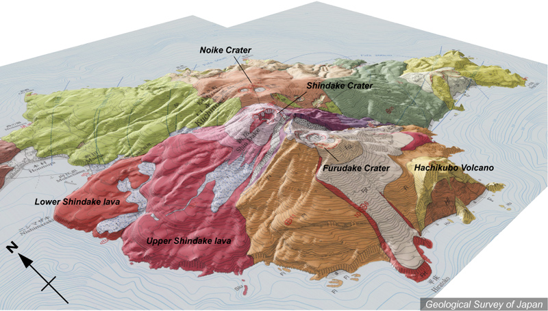
| 地質陰影図(南西→北東、30゜)。古岳火山の上部、新岳火山、鉢窪火山が1万年より若い火山体。 | |||
| 地質図:下司信夫・小林哲夫(2007)口永良部島火山地質図。火山地質図14、産業技術総合研究所地質調査総合センター。 | |||
| Topographic relief of Kuchinoerabujima Volcano combined with geological map (tilted by 30°from the SW to the NE). Shindake Volcano, Upper part of Furudake Volcano and Hachikubo Volcano are formed during last 10 thousand years. | K. Nakajima |