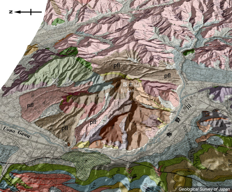
| 地質陰影図(西→東、45°)。飯士山山頂付近はいくつかの開析された溶岩ドームの集合体であり、裾野には火砕流堆積物(pfl)や小規模な扇状地が広がる。魚野川は火山の成長に伴い、西方に屈曲した。 | |||
| 地質図:茅原一也ほか(1981)越後湯沢地域の地質。地域地質研究報告(5万分の1図幅)、地質調査所、108p。 | |||
| Topographic relief of Iiji Volcano combined with geological map (tilted by 45 degree from the W to the E). There are several disected lava domes near the summit, and pyroclastic flow deposits (pfl) are distributed on the slope. | Map
courtesy of K. Nakajima |
||