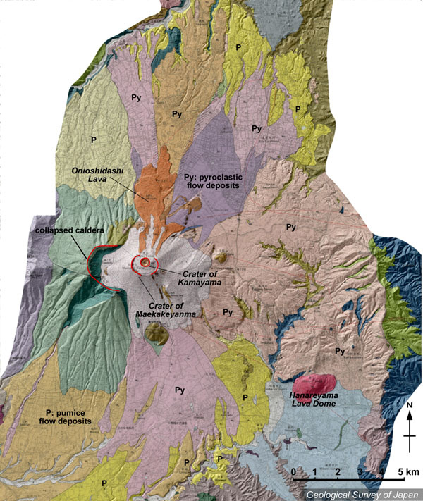
| 地質陰影図。三重になった山頂部は西から黒斑山、前掛山、釜山。釜山からは1783年の鬼押出溶岩(茶色)が北に流れている。北と南斜面には軽石流などの火砕流が広がっている。南東の山(赤)は離山溶岩ドーム。 | |
|
|
| 地質図:荒牧重雄(1993)浅間火山地質図。火山地質図6、地質調査所。 | |||
| Topographic relief of Asama Volcano combined with geological map by Aramaki (1993). Onioshidashi lava flow which erupted from Kamayama crater in 1783 is distributed in the northern side of Kamayama. Pyroclastic flow deposits (Py) are distributed on the northern and southern slopes. | Map
courtesy of K. Nakajima |
||