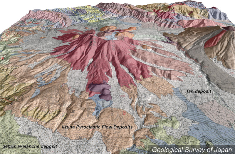
| 地質陰影図(東→西、25°)。解析された山体の火山麓には岩屑なだれ堆積物、火砕流堆積物や山麓扇状地堆積物が広がる。 | |
|
|
| 地質図:長森英明・古川竜太・早津賢二(2003)戸隠地域の地質。地域地質研究報告(5万分の1地質図幅)、産業技術総合研究所地質調査総合センター、109p。 | |||
| Topographic relief combined with geological map around Iizuna Volcano (tilted by 25 degree from the E to W). Debris avalanche, pyroclastic flow and alluvial fan deposits are widely distributed around the dissected volcano. | K. Nakajima |