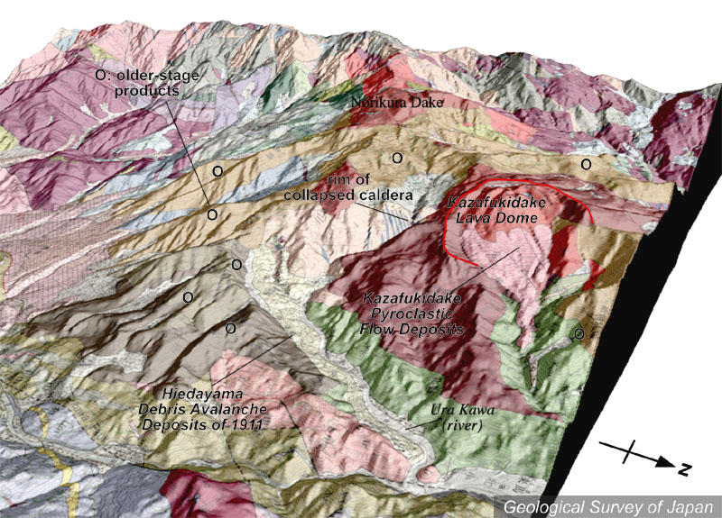
| 地質陰影図(東北東→西南西、20°)。中央やや右に馬蹄形カルデラと風吹岳溶岩ドーム。溶岩ドームは北東側が一部ずれ落ちている。その奥に乗鞍岳(茶色)。背景には白馬三山。手前中央の谷、浦川は、1911年に発生した稗田山の崩壊堆積物(淡黄色)で埋積されている。 | |
|
|
| 地質図:中野 俊・竹内 誠・吉川敏之・長森英明・苅谷愛彦・奥村晃史・田口雄作(2002)白馬岳地域の地質。地域地質研究報告(5万分の1地質図幅)、産総研地質調査総合センター、105p。 | |||
| Topographic relief around Shirouma-oike Volcano combined with geological map (tilted by 20°from the ENE to the WSW). A horseshoe-shaped caldera and Kazafukidake Lava Dome in the right side. Urakawa River in the front is filled with Hiedayama debris avalanche deposits in 1911. | K. Nakajima |