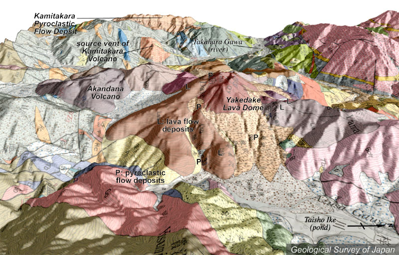
| 地質陰影図(東→西、10°)。中央やや右の焼岳溶岩ドーム(茶色)から手前に火砕流堆積物や土石流堆積物が広がっている。火山群のいちばん左がアカンダナ火山。奥には上宝火山の給源火道と火砕物台地が見える(肌色)。 | |
|
|
| 地質図:原山 智(1990)上高地地域の地質。地域地質研究報告(5万分の1地質図幅)、地質調査所、175p。 | |||
| Topographic relief of combined with geological map around Yakedake Volcano (tilted by 10 degrees from the E to the W). Pyroclastic flow deposits and debris flow deposits in the foreground of Yakedake Lava Dome. Akandana Volcano is located in the left end of volcanoes. | K. Nakajima |