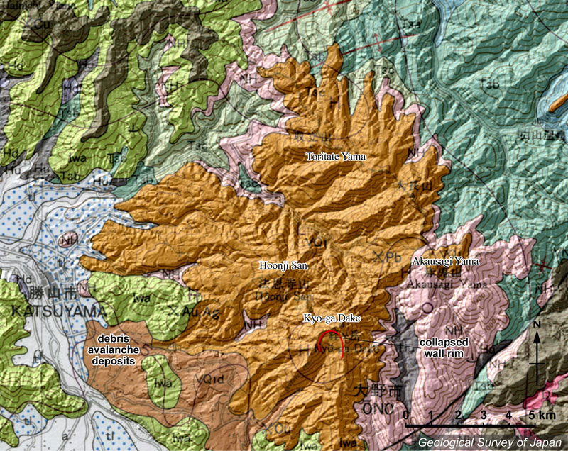
| 地質陰影図。黄土色が経ヶ岳火山。経ヶ岳は図の下部にあり、頂部に南に開いた崩落崖を持つ。法恩寺山も経ヶ岳火山の一部。火山体の南西側に山体崩壊の堆積物が広がる。この地質図では一括されているが、東方ないし北方の赤兎山、大長山、取立山などは取立山火山とした。 | |
|
|
| 地質図:鹿野和彦ほか(1999)20万分の1地質図幅「金沢」、地質調査所。 | |||
| Topographic relief of Kyogadake Volcano combined with geological map, showing Kyogadake on the bottom of the figure with collapsed scarp (opened southward) on the summit. Other mountains, such as Akausagiyama, Ochosan and Toritateyama constitute Toritateyama Volcano. Debris avalanche deposits derived from the collapse of the Kyogadake are distributed in the southwestern side of the volcano. | Map
courtesy of K. Nakajima |
||