八ヶ岳火山群 ______ Yatsugatake Volcano Group |
NS,SA |
|
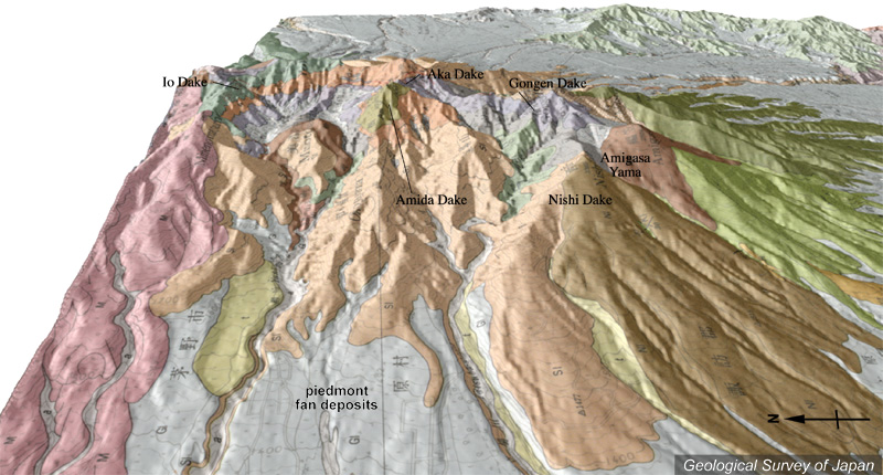
| 地質陰影図(西→東、20゜)。八ヶ岳火山(南八ヶ岳)の中心部の最高峰が赤岳。その手前(西)に阿弥陀岳。赤岳を中心に南北に連なる稜線があり、その西側は大きく崩壊した地形になっている。稜線の左(北)端は硫黄岳、右(南)端には編笠山(茶色)。 | |
|
|
| 地質図:河内晋平(1977)八ガ岳地域の地質。地域地質研究報告(5万分の1図幅)、地質調査所、92p。 | |||
| Topographic relief of Yatsugatake Volcano combined with geological map (tilted by 20 degrees from the W to the E), showing S-N trending ridge centered around Akadake (the highest peak). There are large-scale collapse scarps in the western side of the ridge. | Map
courtesy of K. Nakajima |
||