日本の火山 > 第四紀火山 > 個別火山 > 画像集 > 画像
Volcanoes of Japan > Quaternary Volcanoes > Volcano > Photo Gallery > Image
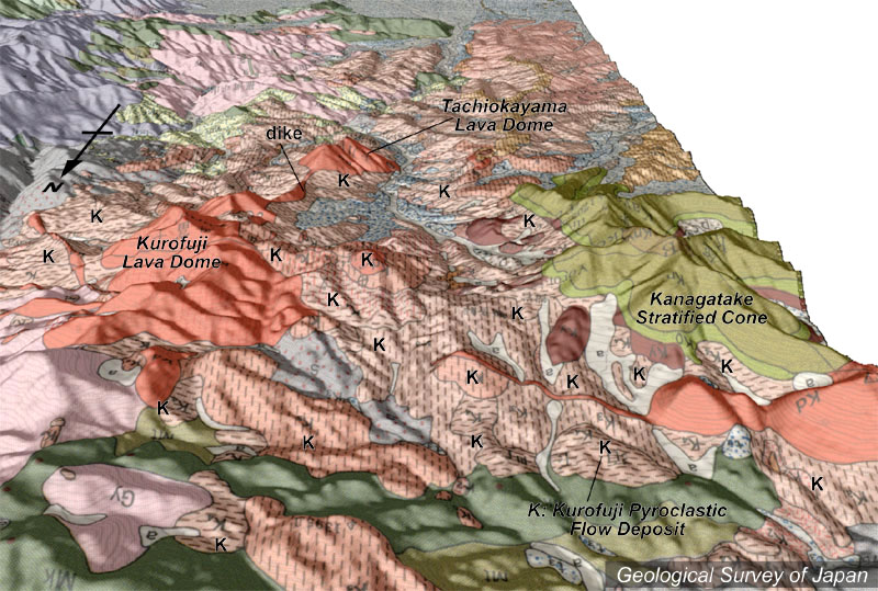
黒富士火山群______ Kurofuji Volcano Group |
NS,SA |
|
| 地質陰影図(北→南、30°)。東(左)が黒富士溶岩ドーム(橙色)、西(右)が茅ヶ岳成層火山(草色)。周囲にはおもに黒富士火山の火砕流堆積物(K)が広がる。 | |
|
|
| 地質図:三村弘二ほか(1984)御岳昇仙峡地域の地質。地域地質研究報告(5万分の1図幅)、地質調査所、61p。 | |||
| Topographic relief of Kurofuji Volcano combined with geological map (tilted by 30 degrees from the N to the S), showing Kurofuji lava domes on the left, and Kayagatake stratovalcano on the right. Pyroclastic flow deposits (K) distribute around them. | Map
courtesy of K. Nakajima |
||