日本の火山 > 第四紀火山 > 個別火山 > 画像集 > 画像
Volcanoes of Japan > Quaternary Volcanoes > Volcano > Photo Gallery > Image
横当島 ______ Yokoate Jima |
NS,SA |
|
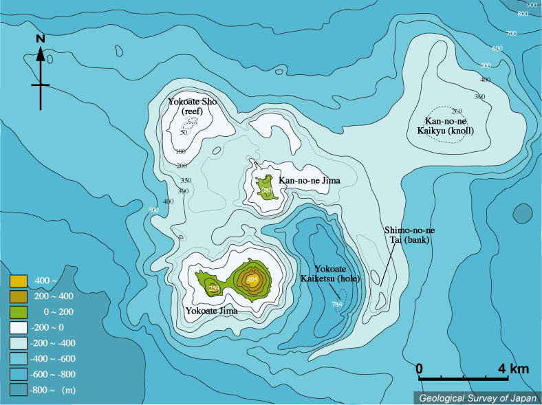
横当島周辺の海底地形。横当島東方に顕著な弧状の高まり(下ノ根堆)がある。横当島の南方から下ノ根堆、上ノ根島東方、横当礁と続く、直径約7×10km程度の大きさの楕円形の海底カルデラとみなせる地形がある。横当島、上ノ根島いずれも後カルデラ火山と考えられる。5万分の1沿岸の海の基本図「横当島」(海上保安庁水路部、1987)より作成。 |
|
|
|
| Bathymetric map around Yokoate-Jima. Submarine caldera with a diameter of 7 by 10 km is presumed. Yokoate-Jima and Kan-no-ne Jima are considered to be post-caldera volcanoes. Created from the Basic Maps of the Sea " Yokoate-Jima" at the scale of 1:50,000 (Japan Coast Guard, 1987). | Map courtesy of M. Tanaka |
||