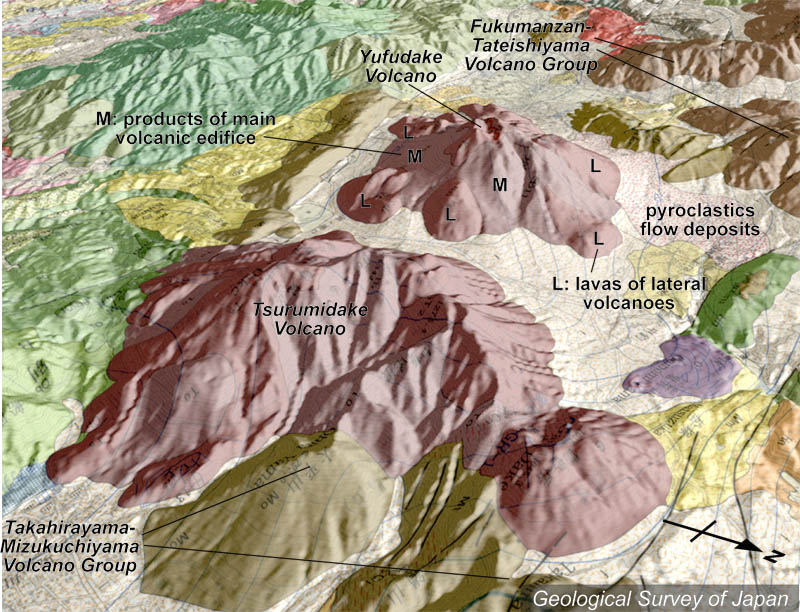
地質陰影図(北東→南西、30°)。中央が鶴見岳、右手前は溶岩ドームの伽藍岳。鶴見火山の奥は由布火山。鶴見火山は主火山体と溶岩ドーム群などから構成される。 |
|
|
|
地質図:星住英夫ほか(1988)別府地域の地質。地域地質研究報告(5万分の1地質図幅)、地質調査所、131p。 |
|||
Topographic relief around Yufu-Tsurumi Graben area combined with geological map (tilted by 30° from the NE to the SW). Tsurumidake (foreground), Garandake Lava Dome (right side of Tsurumidake) and Yufudake Volcano in the middle. Tsurumidake Volcano consists of a main stratovolcano edifice and lava domes. |
K. Nakajima |