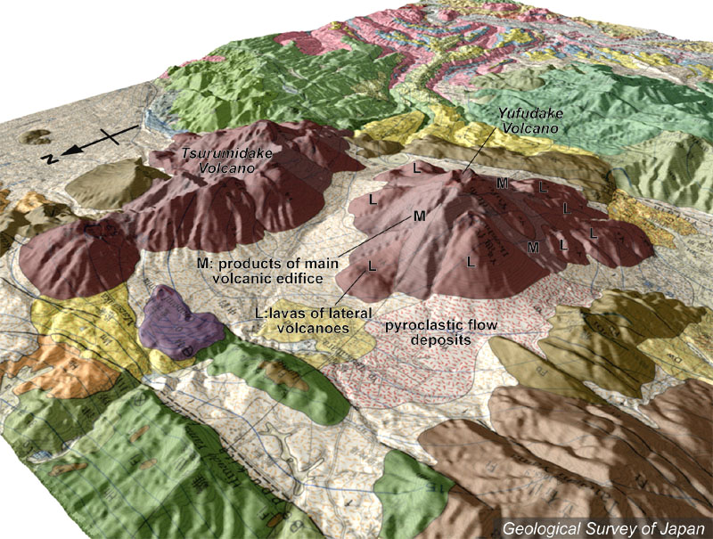
| 地質陰影図(北西→南東、30°)。右が由布火山、左が鶴見火山。由布火山は主火山体と側火山溶岩などから構成される。手前には火砕流堆積物が広がる。 | |
|
|
| 地質図:星住英夫ほか(1988)別府地域の地質。地域地質研究報告(5万分の1地質図幅)、地質調査所、131p。 | |||
| Topographic relief around Yufu-Tsurumi Graben area combined with geological map (tilted by 30° from the NW to the SE). Yufudake Volcano on the right and Tsurumidake Volcano on the left. Yufudake Volcano consist of a main stratovolcano edifice and lava flows erupted from lateral cones. Ignimbrite plateau extending in the foreground. | Map courtesy of K. Nakajima |
||