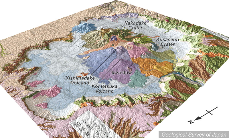
地質陰影図(北西→南東、30°)。カルデラの直径は東西18km、南北25kmで、面積は約380平方kmもある。カルデラ壁の高さは300-700mで、西縁が破れ熊本平野に川が流下している。カルデラの外は緩傾斜の火砕流台地(淡桃色、淡肌色)が広がる。中央に多数の中央火口丘がある。 |
|
|
|
| 地質図:小野晃司・渡辺一徳(1985)阿蘇火山地質図。火山地質図4、地質調査所。 | |||
Topographic relief of Aso Caldera combined with geological map (tilted by 30° from the NW to the SE). The caldera is ca. 18 x 25 km in diameter, with caldera floor of ca. 380 km2 and height of caldera wall of ca. 300-700 m. The river cutting through the western caldera rim debouched into Kumamoto Plain. Ignimbrite plateau (pale pink and pale orange) with gentle morphology extending outside the caldera rim. Many central cones in the middle. |