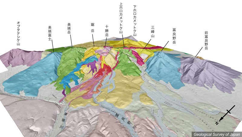
地質陰影図(北西→南東、20゚)。数万年前以降の新期の活動は十勝岳山頂の北側-西側が中心で、溶岩流や火砕流が山麓まで流下している。 |
|||
| 地質図:石塚吉浩・中川光弘・藤原伸也(2010)十勝岳火山地質図。火山地質図16、産業技術総合研究所地質調査総合センター。 | |||
| Topographic relief around Tokachidake Volcano combined with geological map (tilted by 20°from the NW to the SE). Volcanic products of the Younger Stage (0.06 Ma to present) are mainly distributed to the NW of the summit of Tokachidake. | K. Nakajima |