日本の火山 > 第四紀火山 > 個別火山 > 画像集 > 画像
Volcanoes of Japan > Quaternary Volcanoes > Volcano > Photo Gallery > Image
久場島 ______ Kuba Jima |
NS,SA |
|
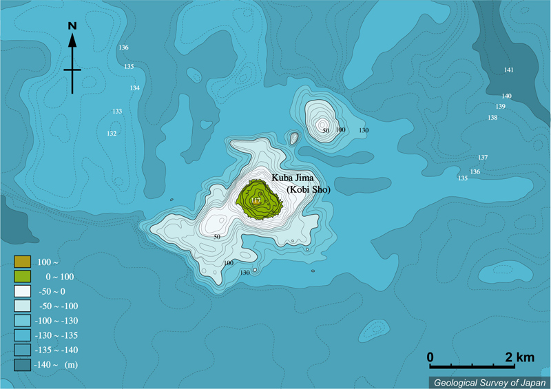
久場島(黄尾嶼)周辺の海底地形。久場島を中心に北東-南西6kmに伸びた、水深130m付近からの高まりがある。5万分の1沿岸の海の基本図「久場島」(海上保安庁水路部、1995)より作成。 |
|
|
Bathymetric map around Kobisho Volcano,
showing 6 km long uplift at the depth of shallower than 130 m from
NE to SW. Created from the Basic Maps of the Sea "Kuba-jima" at
the scale of 1:50,000 (Japan Coast Guard, 1995). |