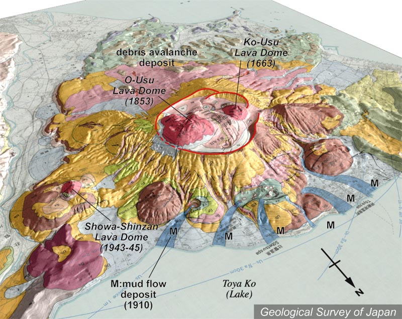
| 地質陰影図(およそ北北東→南南西、35°)。カルデラの中や周囲はいくつもの溶岩ドームと潜在溶岩ドームが分布する。洞爺湖に流れ込んでいる水色の帯は、1910年の火山泥流。 |
|
|
|
| 地質図:曽屋龍典ほか(1981)有珠火山地質図。火山地質図2、地質調査所。 | |||
| Topographic relief of Usu Volcano combined with geological map (tilted by 35° from the NNE to SSW). Several lava domes and cryptodomes inside and outside of caldera. 1910 mud flows (blue) entered Lake Toya. | K. Nakajima |