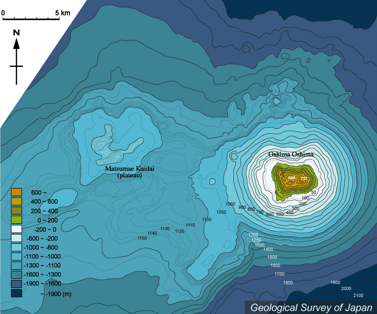
| 渡島大島周辺の海底地形図。火山体の大部分は海面下にある。渡島大島北側に崩壊地形がある。5万分の1沿岸の海の基本図「松前大島」(海上保安庁水路部、1978)より作成。 |
|
|
| Bathymetric map around Oshima O-shima based on Basic Map of the Sea (1:50,000) "Matsumae Oshima" (Japan Coast Guard, 1978) showing flank collapse-related topography at the northern part. Most of the volcanic edifice is under water. | M. Tanaka |