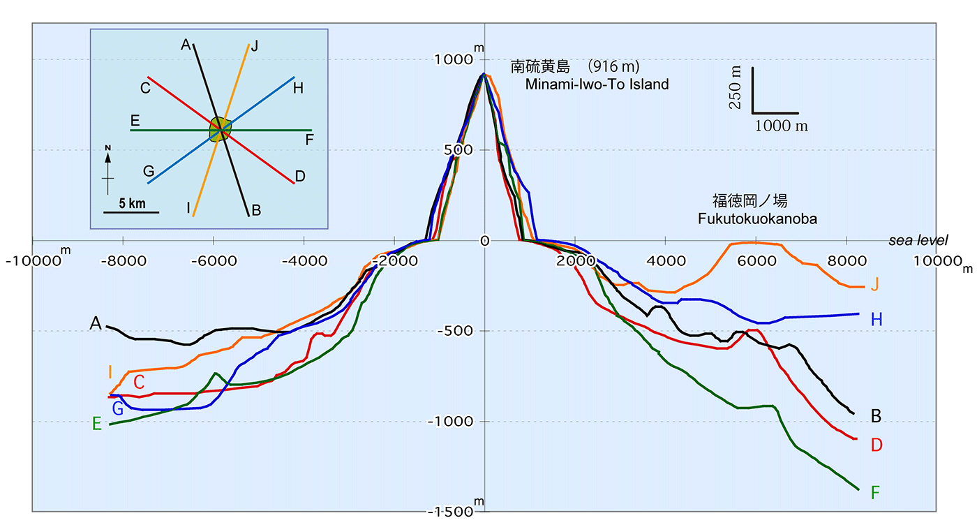
| 南硫黄島周辺の海底地形断面図。水平:垂直=1:4。地形は5万分の1沿岸の海の基本図「南硫黄島」(海上保安庁水路部、1993)に基づく。 |
|
|
|
| 中野 俊(2025)南硫⻩島の全岩主成分化学組成と岩脈分布.産総研地質調査総合センター研究資料集,no.768,産総研地質調査総合センター、第6図。 | |||
| Cross sections around Minami-Io-To Island. Vertical exaggeration = 4, based on the bathymetric map (Japan Coast Guard, 1993). | Graph courtesy of S. Nakano |
||