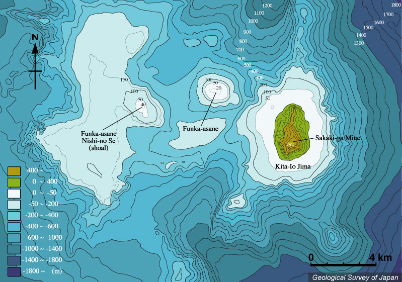
| 北硫黄島および噴火浅根周辺の海底地形。噴火浅根は底径3-4kmの円錐形の海底火山。噴火浅根を取り囲むように、北硫黄島北方、噴火浅根南方、噴火浅根西ノ瀬の西から北へ続く直径8×12km程度の埋没したカルデラらしき地形が推定される。北硫黄島はその“カルデラ”の外側に位置する。5万分の1沿岸の海の基本図「北硫黄島」(海上保安庁水路部、1994)より作成。 |
|
|
| Bathymetric map around Kita Io-jima and Funka Asane based on Basic Map of the Sea (1:50,000) "Kita Io-jima" (Japan Coast Guard, 1994). Funka Asane is a conical seamount (basal diameter 3-4 km) surrounded by a buried caldera-like structure (ca. 8 x 12 km) continued from north of Kita Io-jima, south of Kita Io-jima through the west and to the north of Funka Asane Nishinose. | M. Tanaka |