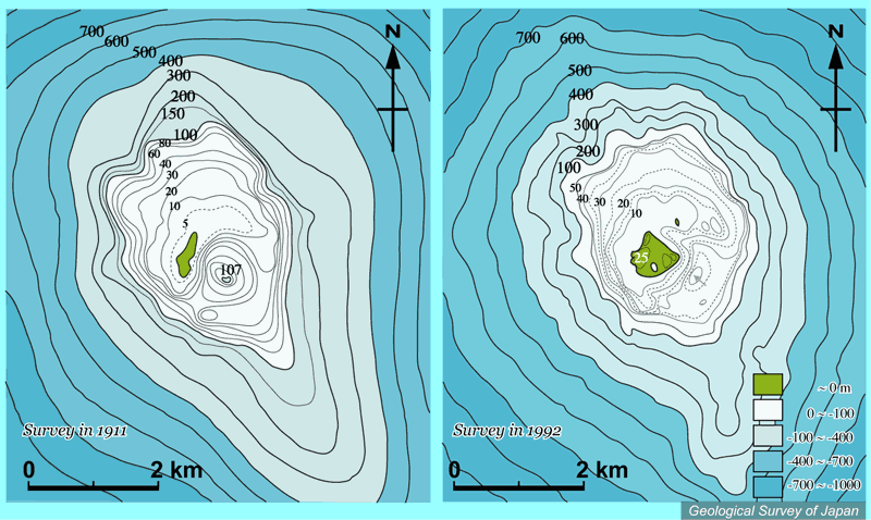
| 西之島周辺の海底地形の比較(左:1911年測量、右:1992年測量)。1973-74年噴火噴出物で、海底の火口地形の大部分は埋め立てられた。噴火前の1911年調査は小坂(1973)より、噴火後の1992年調査は5万分の1沿岸の海の基本図「西之島」(海上保安庁水路部、1993)より作成。 |
|
|
|
| Comparison of bathymetric maps (1911 and 1992) around Nishino-shima before and after 1973 eruption. Bathymetric map after the eruption is based on 1:50,000 basic map of the sea "Nishino-shima" (documented in 1992; Japan Coast Guard, 1993) while that prior to the eruption is based on mapping in 1911 (Ossaka, 1973). | |||