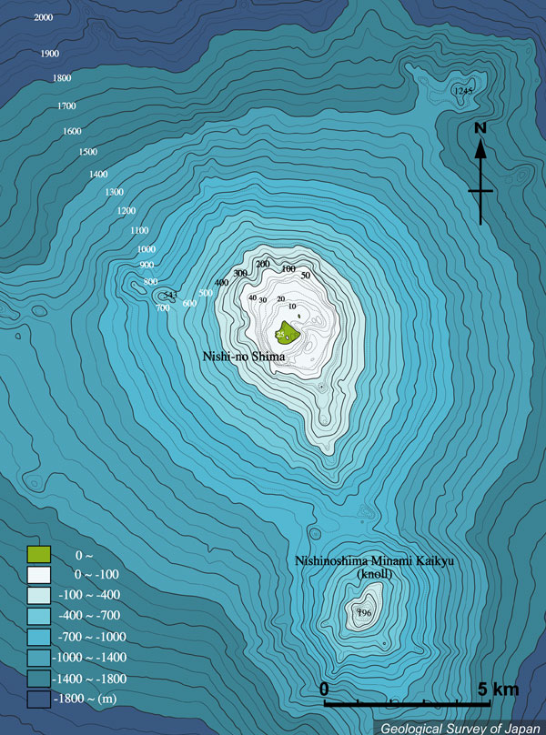
| 西之島周辺の海底地形(1992年測量)。西之島南東に凹地があり、直径2km程度の火口地形の中心と考えられ、旧島(西之島西半分)は火口縁にあたる。5万分の1沿岸の海の基本図「西之島」(海上保安庁水路部、1993)より作成。 |
|
|
|
| Bathymetric map around Nishino-shima (surveyed in 1992) based on Basic Map of the Sea (1:50,000) "Nishino-shima" (Japan Coast Guard, 1993) showing ca. 2 km diameter depression (presumably a crater) at the southeast of Nishino-shima. Older island (western half of Nishino-shima Island) is part of crater rim. | |||