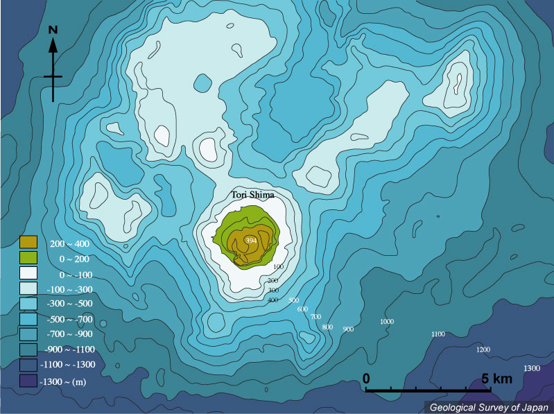
| 鳥島付近の海底地形。5万分の1沿岸の海の基本図「鳥島」(海上保安庁水路部、1996)より作成。 |
|
|
|
| Bathymetric map around Tori-shima based on Basic Map of the Sea (1:50,000) "Tori-shima" (Japan Coast Guard, 1999). |
日本の火山 > 第四紀火山 > 個別火山 > 画像集 > 画像
Volcanoes of Japan > Quaternary Volcanoes > Volcano > Photo Gallery > Image
伊豆鳥島 ______ Izu Tori Shima |
SM |
|
| 鳥島付近の海底地形。5万分の1沿岸の海の基本図「鳥島」(海上保安庁水路部、1996)より作成。 |
|
|
|
| Bathymetric map around Tori-shima based on Basic Map of the Sea (1:50,000) "Tori-shima" (Japan Coast Guard, 1999). |