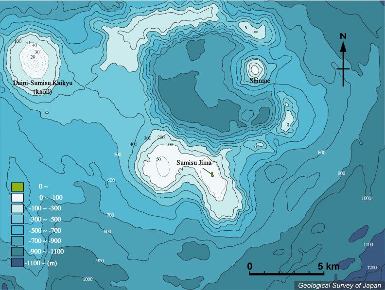
| 須美寿島付近の海底地形。須美寿島はスミスカルデラ(直径6.6 × 8.3 km、カルデラ床水深 800-900 m)のカルデラ外にある。5万分の1沿岸の海の基本図「須美寿島」(海上保安庁水路部、1997)より作成。 |
|
|
|
| Bathymetric map around "Smith Rocks (Sumisu-jima)" based on Basic Map of the Sea (1:50,000) "Sumisu-jima" (Japan Coast Guard, 1997). "Smith Rocks (Sumisu-jima)" is a group of islets located on the rim of submarine Smith Caldera (6.6 x 8.3 km diameter, caldera floor at ca. 800-900 m b.s.l.). |