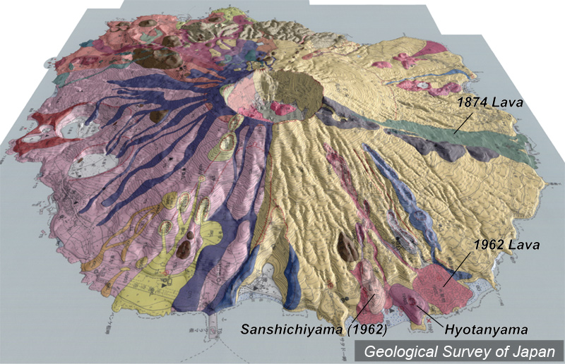
| 地質陰影図(東→西、35°)。北東では1940年と1962年の噴火割れ目がほぼ同じ方向に形成された。ひょうたん山は1940年の火砕丘。 |
|
|
|
| 地質図:津久井雅志ほか(2005)三宅火山地質図。火山地質図no.12、産業技術総合研究所地質調査総合センター。 | |||
| Topographic relief of Miyakejima Volcano combined with geological map (tilted by 35 degrees from the E to the W). Fissure eruption in 1940 and 1962 occurred at nearly the same direction. Hyotanyama Pyroclastic Cone was formed in 1940 and Sanshichiyama Pyroclastic Cone formed in 1962. | Map courtesy of K. Nakajima |
||