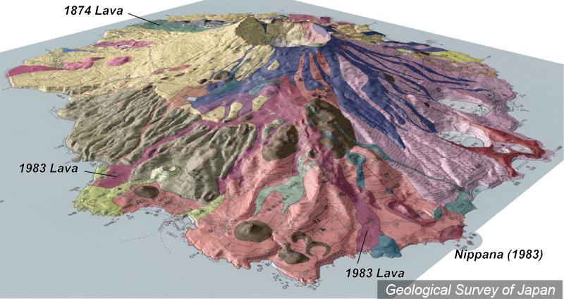
| 地質陰影図(南西→北東、25°)。1983年の噴火割れ目は南西中腹から海岸まで達した。海岸の新鼻やその北側の新澪池ではマグマ水蒸気爆発が発生した。 |
|
|
|
| 地質図:津久井雅志ほか(2005)三宅火山地質図。火山地質図no.12、産業技術総合研究所地質調査総合センター。 | |||
| Topographic relief of Miyakejima Volcano combined with geological map (tilted by 25 degrees from the SW to the NE). 1983 eruption fissures reached to the sea coast, and phreatomagmatic eruptions occurred at Nippana and Shinmyo-ike. | Map courtesy of K. Nakajima |
||